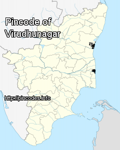
Translate this page:
| Pincode | 626201 |
| Name | Elayirampannai S.O |
| District | Virudhunagar |
| State | Tamil Nadu |
| Status | Sub Office(Delivery) |
| Head Office | Virudhunagar H.O |
| Sub Office | |
| Location | Sattur Taluk of Virudhunagar District |
| Telephone No | 4562243092 |
| SPCC | MADURAI-625001 |
| Department Info | Virudhunagar Division Madurai Region Tamilnadu Circle |
| Address | Elayirampannai, Tamil Nadu 626201, India |
| Services | Business Post Direct Post EMS (International Speed Post) E-Payment Epost IFS Inland Speed Post Instant Money Order International Mails Money Order National Bill Mail Service National Pension Scheme Postal Banking Service Postal Life Insurance Postal Stationary Registered Posts |
| Indian Postal Code System Consists of Six digits. The first to digits represent the state, the second two digits represent the district and the Third two digits represents the Post Office.In this case the first two digits 62 represents the state Tamil Nadu, the second two digits 62 represent the district Virudhunagar, and finally 01 represents the Post Office Elayirampannai S.O. Thus the Zip Code of Elayirampannai S.O, Virudhunagar, tamil nadu is 626201 | |
| Pincode | 626201 |
| Name | Karisalpatti B.O |
| District | Virudhunagar |
| State | Tamil Nadu |
| Status | Branch Office(Delivery) |
| Head Office | Virudhunagar H.O |
| Sub Office | Elayirampannai S.O |
| Location | Sattur Taluk of Virudhunagar District |
| Telephone No | Not Available |
| SPCC | MADURAI-625001 |
| Department Info | Virudhunagar Division Madurai Region Tamilnadu Circle |
| Address | Karisalpatti, Tamil Nadu 626201, India |
| Services | |
| Indian Postal Code System Consists of Six digits. The first to digits represent the state, the second two digits represent the district and the Third two digits represents the Post Office.In this case the first two digits 62 represents the state Tamil Nadu, the second two digits 62 represent the district Virudhunagar, and finally 01 represents the Post Office Karisalpatti B.O. Thus the Zip Code of Karisalpatti B.O, Virudhunagar, tamil nadu is 626201 | |
| Pincode | 626201 |
| Name | Panayadipatti B.O |
| District | Virudhunagar |
| State | Tamil Nadu |
| Status | Branch Office(Delivery) |
| Head Office | Virudhunagar H.O |
| Sub Office | Elayirampannai S.O |
| Location | Sivakasi Taluk of Virudhunagar District |
| Telephone No | Not Available |
| SPCC | MADURAI-625001 |
| Department Info | Virudhunagar Division Madurai Region Tamilnadu Circle |
| Address | Tamil Nadu 626201, India |
| Services | |
| Indian Postal Code System Consists of Six digits. The first to digits represent the state, the second two digits represent the district and the Third two digits represents the Post Office.In this case the first two digits 62 represents the state Tamil Nadu, the second two digits 62 represent the district Virudhunagar, and finally 01 represents the Post Office Panayadipatti B.O. Thus the Zip Code of Panayadipatti B.O, Virudhunagar, tamil nadu is 626201 | |
| Pincode | 626201 |
| Name | Sankarapandiapuram B.O |
| District | Virudhunagar |
| State | Tamil Nadu |
| Status | Branch Office(Delivery) |
| Head Office | Virudhunagar H.O |
| Sub Office | Elayirampannai S.O |
| Location | Sattur Taluk of Virudhunagar District |
| Telephone No | Not Available |
| SPCC | MADURAI-625001 |
| Department Info | Virudhunagar Division Madurai Region Tamilnadu Circle |
| Address | |
| Services | |
| Indian Postal Code System Consists of Six digits. The first to digits represent the state, the second two digits represent the district and the Third two digits represents the Post Office.In this case the first two digits 62 represents the state Tamil Nadu, the second two digits 62 represent the district Virudhunagar, and finally 01 represents the Post Office Sankarapandiapuram B.O. Thus the Zip Code of Sankarapandiapuram B.O, Virudhunagar, tamil nadu is 626201 | |

Virudhunagar, formerly known as Virudhupatti, is a town and the administrative headquarters of the Virudhunagar district in the South Indian state of Tamil Nadu. It is located 506 km (314 mi) southwest of the state capital Chennai and 53 km (33 mi) south of Madurai. Virudhunagar emerged as an important trade centre during the British rule. The town is the birthplace of freedom fighter K. Kamaraj, former chief minister of Tamil Nadu, and Bharat Ratna recipient. Located to the east of Kowsika River, Virudhunagar has an average elevation of 102 m (335 ft) above sea level and is largely flat with no major geological formations. The town has a humid climate and receives 780 mm (31 in) rainfall annually. Virudhunagar was a part of Madurai and has been ruled at various times by Later Pandyas, Vijayanagar Empire, Madurai Nayaks, Chanda Sahib, Carnatic kingdom and the British.
Virudhunagar is administered by a municipality coveringMore Info